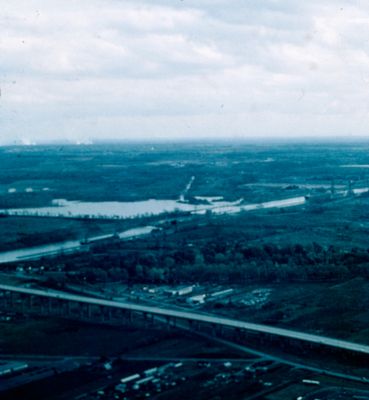
Aerial View of The St. Catharines Skyway
Description
- Media Type
- Image
- Item Type
- Slides
- Description
- An aerial view of St. Catharines looking south-east at the St. Catharines Skyway. The Welland Canal is in the background.
- Notes
- Slide File Number: 08.20-E-2
The St. Catharines Skyway opened for traffic in 1963. - Date of Original
- c. 1963-1973
- Subject(s)
- Geographic Coverage
-
-
Ontario, Canada
Latitude: 43.16681 Longitude: -79.24958
-
- Copyright Statement
- Copyright status unknown. Responsibility for determining the copyright status and any use rests exclusively with the user.
- Contact
- St. Catharines Public LibraryEmail:info@myscpl.ca
Website:
Agency street/mail address:54 Church St.
St. Catharines, ON L2R7K2
905-688-6103

