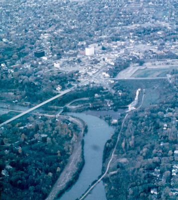
Aerial View of St. Catharines
Description
- Médias
- Image
- Type d'élément
- Slides
- Description
- An aerial view of St. Catharines looking north-east toward downtown. The 12 Mile Creek and the Glenridge Fill are in the centre of the image.
- Notes
- Slide File Number: 08.21-C-4
The Glen ridge (later Glenridge) Bridge crossed the valley of the 1st and 2nd Welland Canals. By 1955 the bridge was showing severe structural issues and had to be demolished.
The bridge was replaced by the "Fill," an earthen embankment which enabled road access across the valley where the bridge had been. The Fill remained in use until a new Glendridge Bridge was built, opening for traffic in Dec. 1980. - Date de l'original
- c. 1963-1973
- Sujet(s)
- Couverture géographique
-
-
Ontario, Canada
Latitude: 43.16681 Longitude: -79.24958
-
- Déclaration de droit d'auteur
- Copyright status unknown. Responsibility for determining the copyright status and any use rests exclusively with the user.
- Contacter
- St. Catharines Public LibraryCourriel:info@myscpl.ca
Adresse Internet:
Adresse postale d'agence54 Church St.
St. Catharines, ON L2R7K2
905-688-6103