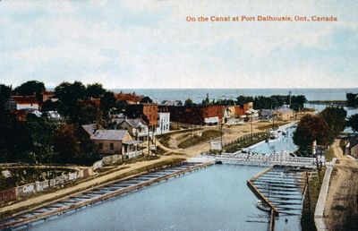
Aerial view of the Welland Canal at Port Dalhousie
Description
- Media Type
- Image
- Item Type
- Slides
- Description
- An aerial view of the Welland Canal at Port Dalhousie. Lock 1 of the 2nd Welland Canal and a swing bridge are in the foreground. The intersection of Lock and Front Streets is to the left, and the harbour is on the right. Lake Ontario is visible in the distance, as are the parallel piers and lighthouses.
- Notes
- Slide File Number: 06.104-C-2
Second Welland Canal: 1845-1915
Port Dalhousie was amalgamated with St. Catharines in 1961. - Inscriptions
- On the Canal at Port Dalhousie, Ont., Canada
- Date of Original
- Date Unknown
- Subject(s)
- Language of Item
- English
- Geographic Coverage
-
-
Ontario, Canada
Latitude: 43.20011 Longitude: -79.26629
-
- Copyright Statement
- Copyright status unknown. Responsibility for determining the copyright status and any use rests exclusively with the user.
- Contact
- St. Catharines Public LibraryEmail:info@myscpl.ca
Website:
Agency street/mail address:54 Church St.
St. Catharines, ON L2R7K2
905-688-6103

