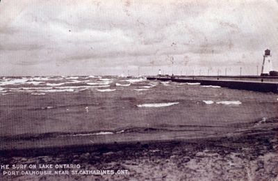
Lake Ontario, Port Dalhousie
Description
- Media Type
- Image
- Description
- A black and white image of the Lake Ontario, Port Dalhousie.
- Notes
- Slide File Number: 06.101-E-1
The pier was built at the time of the second canal,
c. 1845.
The outer range lighthouse was built c. 1879. The inner range lighthouse was constructed c. 1898 to replace an earlier one destroyed by lightening. - Inscriptions
- [T]HE SURF ON LAKE ONTARIO PORT DALHOUSIE, NEAR ST. CATHARINES, ONT.
- Date of Original
- Date Unknown
- Subject(s)
- Language of Item
- English
- Geographic Coverage
-
-
Ontario, Canada
Latitude: 43.20011 Longitude: -79.26629
-
- Copyright Statement
- Copyright status unknown. Responsibility for determining the copyright status and any use rests exclusively with the user.
- Contact
- St. Catharines Public LibraryEmail:info@myscpl.ca
Website:
Agency street/mail address:54 Church St.
St. Catharines, ON L2R7K2
905-688-6103

