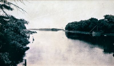
The Welland River at Chippawa
Description
- Media Type
- Image
- Item Type
- Slides
- Description
- The Welland River, looking east from a bridge, at Chippawa, Ontario. Date Unknown.
Visible is Dr. Gray's Boathouse. - Notes
- Slide File Number: 02.34-B-3
The first Welland Canal initially entered the Welland River via a lock at Port Robinson. Ships would then sail down the river to Chippawa and enter the Niagara River to sail to Fort Erie. After the canal was extended to Port Colborne, this water way was used for local navigation. - Subject(s)
- Geographic Coverage
-
-
Ontario, Canada
Latitude: 43.0595432715994 Longitude: -79.0522581401062
-
- Copyright Statement
- Copyright status unknown. Responsibility for determining the copyright status and any use rests exclusively with the user.
- Contact
- St. Catharines Public LibraryEmail:info@myscpl.ca
Website:
Agency street/mail address:54 Church St.
St. Catharines, ON L2R7K2
905-688-6103

